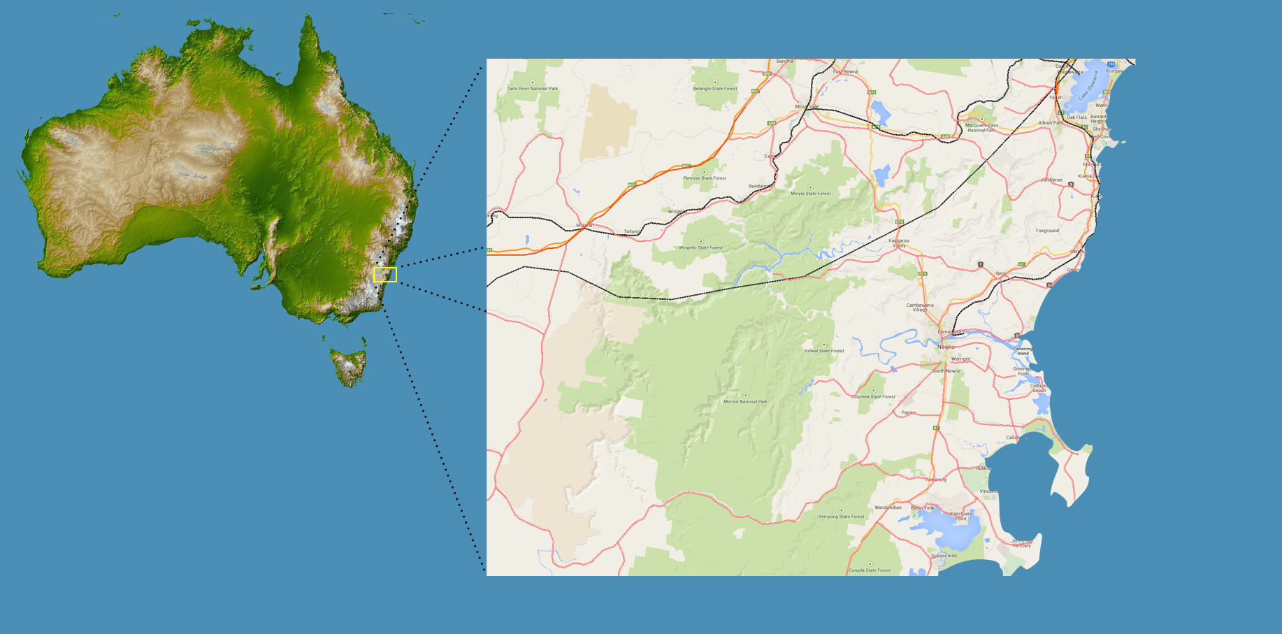
Click each point for more information on South Coast attractions
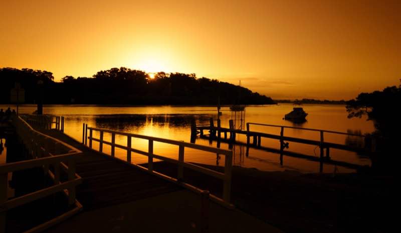
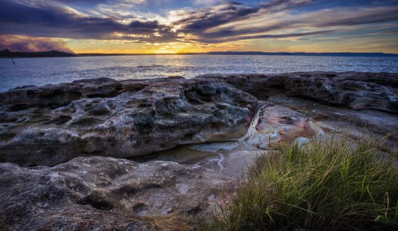
JERVIS BAY
The Jervis Bay is an 102-square-kilometre oceanic bay on the south coast of New South Wales, Australia.
A 70-square-kilometre area of land around the southern headland of the bay is a territory of the Commonwealth of Australia known as the Jervis Bay Territory. The Australian Navy base, HMAS Creswell, is in the Jervis Bay Territory between Jervis Bay Village and Greenpatch Point.
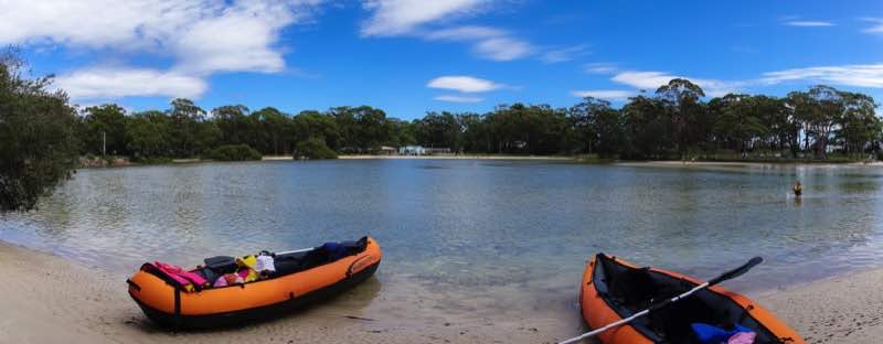
Jervis Bay is well-known for recreational fishing and scuba diving, with tour operators departing from Huskisson and amateurs using boat ramps at bayside towns and camp sites. Popular diving sites include The Labyrinths, Gorgonian Wall, Point Perpendicular, a submerged Fairey Firefly aeroplane, scallop beds, Middle Ground, Ten Fathom Reef, and Bowen Island.
Jervis Bay is also known for whale watching, because whale migration, both north and south, can be observed as the animals pass the entrance to the bay, frequently entering the sheltered waters to rest. The majority of whales sighted at Jervis Bay are Humpbacks, which migrate along Australia's east coast from June to November. Southern Right Whales are also showing a slow but steady increase in recent years as they re-colonize former habitats, having been extensively hunted in the 19th and 20th centuries. Other species sighted have been False Killer Whales, Orcas, Minke whales and, on one occasion, a Blue Whale.
ORIENT POINT
Orient Point is a small village in the Shoalhaven area of New South Wales, Australia. It is located on the southern side of the mouth of the Shoalhaven River and adjoins the village of Culburra to the south. The Jerringa Aboriginal Mission is located near the village. At the 2006 census, Orient Point had a population of 504 people.
HUSKISSON
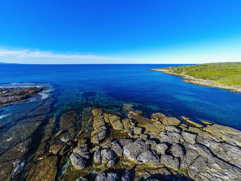
Wrapped around the vast blue playground of Jervis Bay Marine Park, Huskisson is a natural magnet for fans of water sports and classic Australian beach holidays. Fishing, diving, snorkelling and sailing all rank high here while the beaches are pristine, well protected and great for families.
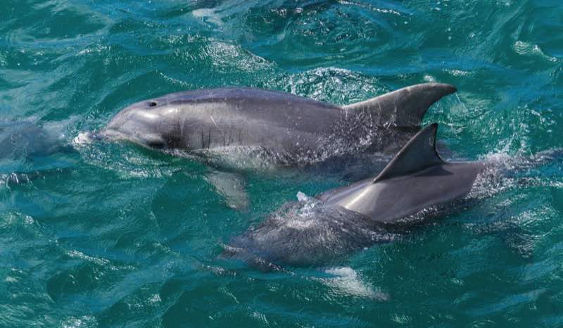
Migrating whales are often sighted inside the bay between May and November while fur seals and dolphins can be seen from cruise vessels based in Huskisson. This is Australia's most northerly fur seal colony, as well as the only mainland colony.
At Huskisson, the Lady Denman Museum relates the fascinating history of Jervis Bay from the different persepectives of whalers, timber cutters and local Aboriginal people. You'll see shipwecks, lighthouses, some outstanding examples of the boatbuilder's craft and the history of the bay's naval base.
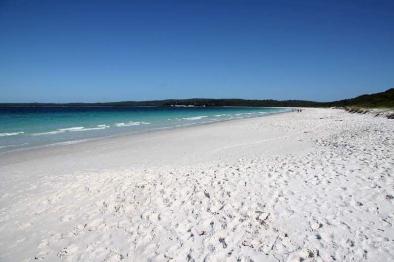

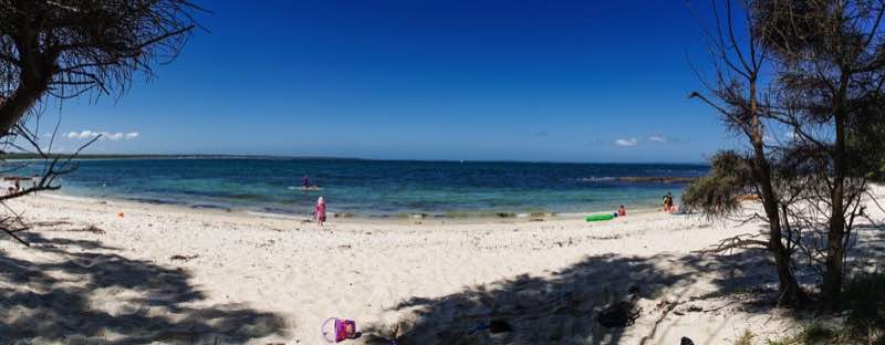
HYAMS BEACH
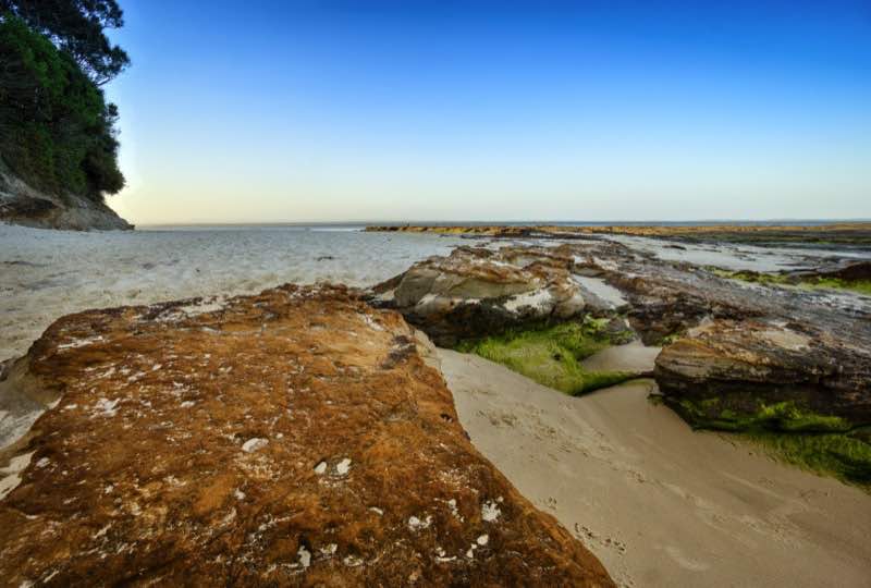
Hyams Beach is a seaside village with a population of 290 in the Shoalhaven, New South Wales, Australia, on the shores of Jervis Bay. The village, 180 km south of Sydney, is bordered by 2 beaches, Chinaman's Beach to the north and Seaman's Beach (sometimes referred to as "Sailors Beach") to the south. Hyams Beach is the beach in the centre.
The beaches face east, out across Jervis Bay and Point Perpendicular to the Pacific Ocean. The sand at these beaches is known for being fine, soft, and brilliantly white. The Guinness Book of Records reports Hyams Beach as having the whitest sand in the world.
The village is bordered by Jervis Bay National Park to the north and Booderee National Park and Botanic Gardens to the south which gives Hyams Beach a 'natural bush' feel with an abundance of native plants, animals and birdlife. Other nearby attractions include Jervis Bay Marine Park and surrounding trails and forests.
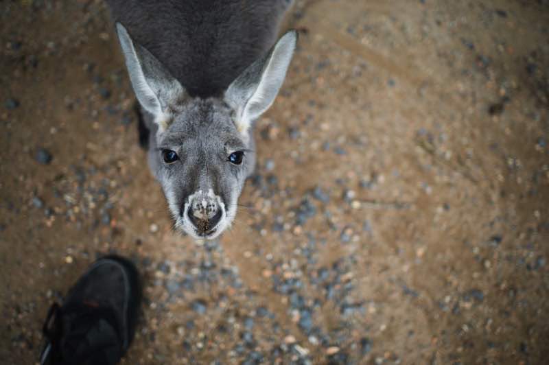
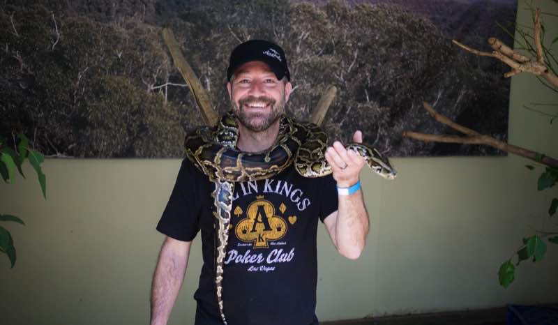
SHOALHAVEN ZOO
Shoalhaven Zoo, formerly the Nowra Animal Park, is an animal park on the South Coast of New South Wales, Australia.
Shoalhaven Zoo is the largest native animal park on the NSW South Coast and holds over 100 species of mostly native mammals, birds and reptiles. The park is set in 16 acres of native bushland and is situated on the Shoalhaven River.
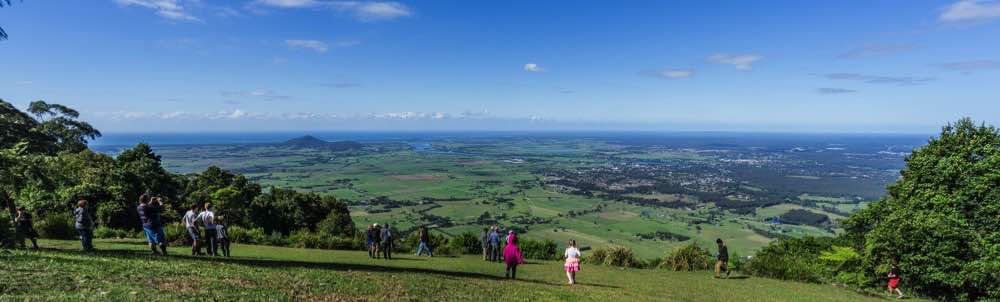
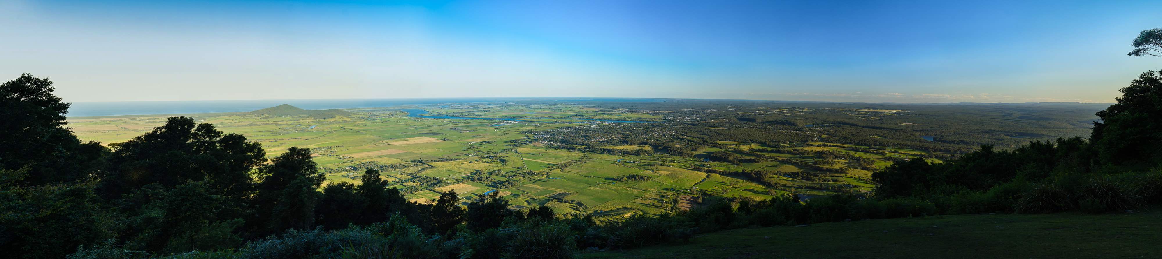
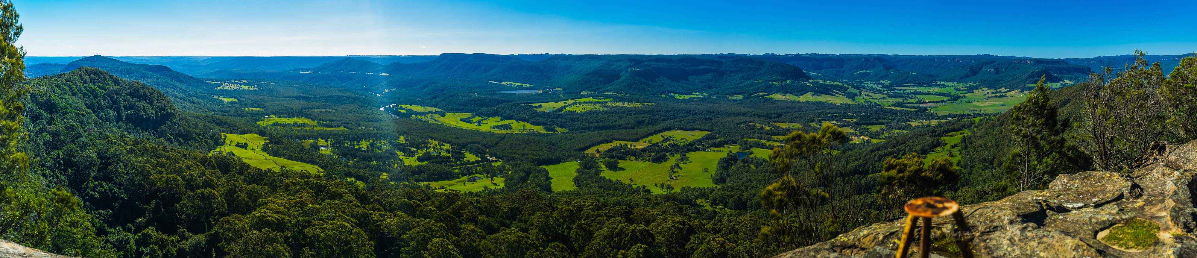
CAMBEWARRA LOOKOUT
The Lookout commands a magnificent panorama of Shoalhaven City, stretching from Coolangatta Mountain in the north, way down to Pigeon House Mountain just inland from Ulladulla, in the south. The view also includes Point Perpendicular and the beautiful Jervis Bay National Park.
While you're absorbing the breathtaking views and the natural beauty of the region, you can also observe the wonderful wildlife that inhabits the area. Magnificent King Parrots, Kookaburras and Lyrebirds are regular visitors and the majestic Wedge Tailed Eagles soaring overhead is a sight to behold, while you sip your cappuccino!
If you visit in the evening, you may even see Mr Wombat ambling across the lawn.
KANGAROO VALLEY
Kangaroo Valley is a rift valley along the Kangaroo River in the Illawarra region of New South Wales, Australia, located west of the seaside in the City of Shoalhaven. It is also the name of the small township within it, formerly known as Osborne, with a population of 844 in the 2011 census. The township is accessed by the Moss Vale Road, which links Moss Vale to the Princes Highway at Bomaderry a little north of Nowra.
The district has a strong artistic community and, since 2007, has mounted a biannual arts and music festival. In 2009, the festival celebrated the 80th birthday of Australian composer Peter Sculthorpe with three concerts devoted to his music.
The annual Folk Festival in October is presented by Shoalhaven Folk Club Inc with local, Australian and international performers at the unique venues on the Showground and throughout quaint village locations.
The pretty and historic township of Kangaroo Valley shares its secrets with a visit to the Pioneer Farm Museum where this historical settlement depicting farm life in the second half of the 19th and early 20th century is brought to life. One of the best and most authentic in the wider Sydney Region! Invigorating bushwalks are available at the back of the museum park including the Walker Suspension Bridge spanning 72m and leading to 2 marked bushwalks on more than seven hectares of natural reserve.
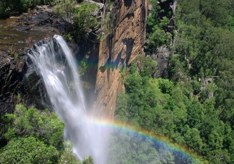
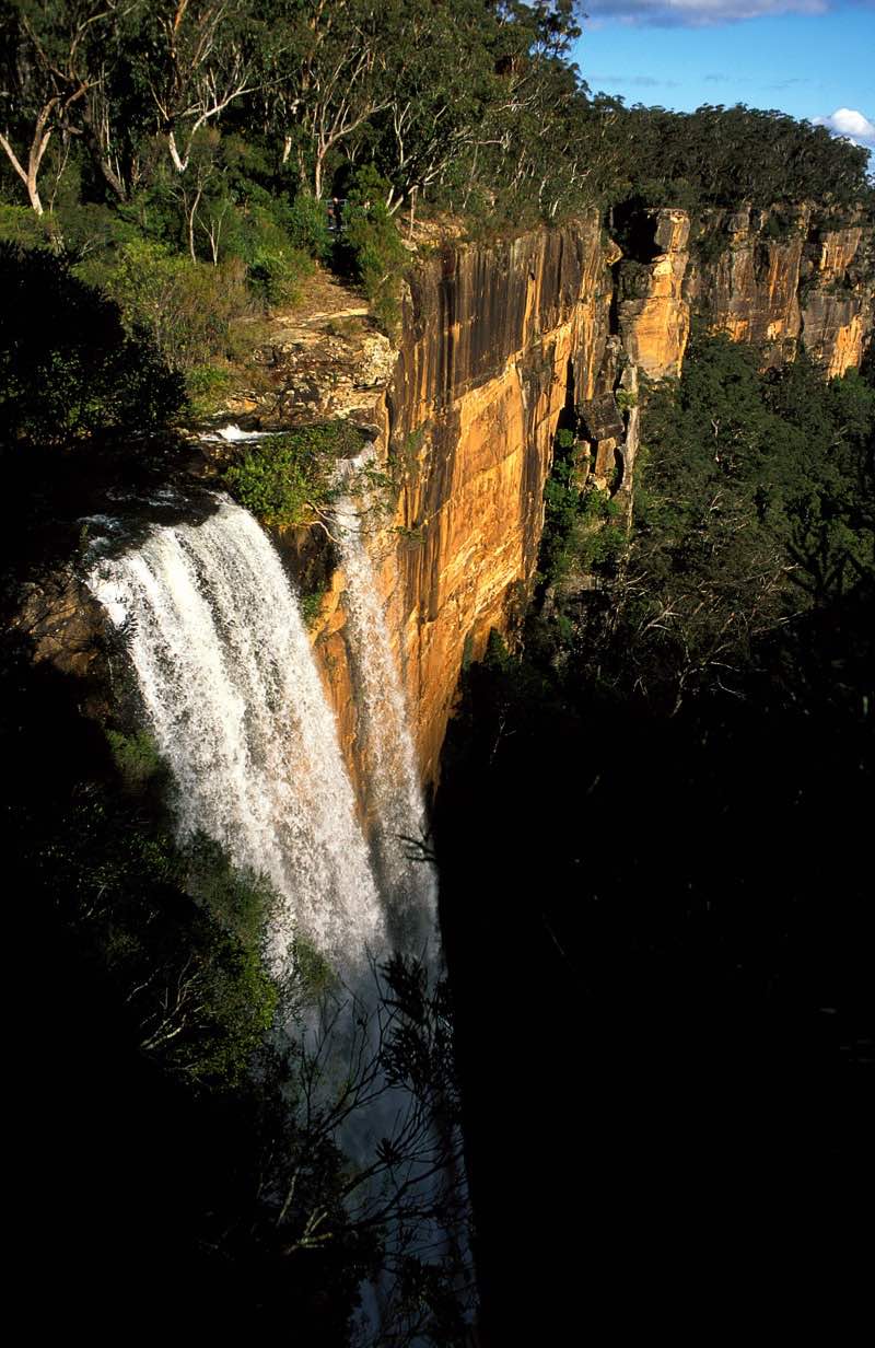
FITZROY FALLS
The waterfall was first discovered by European settlers in the early 19th century by Charles Throsby. Near the head of the Yarrunga Creek in the Morton National Park, the waterfall was named in honour of Sir Charles Fitzroy, the Governor of New South Wales during his visit to the area in 1850.
While a town was planned for the area in the 1860s, little development occurred. With the advent of motor vehicles, Fitzroy Falls became, and still remains, a popular stopping point for tourists travelling towards the Southern Highlands. Substantial parking and catering facilities have been provided, together with pathways and boardwalks which enable able-bodied visitors to view the falls and other spectacular natural features.

BERRY
Berry is a small Australian town in the Shoalhaven region of the NSW South Coast in the state of New South Wales, located 145 km south of the state capital, Sydney.
History: The indigenous people of the area were the Wodi Wodi people. In the 1810s, George William Evans, Government Surveyor, reported on the Berry district as a possible settlement and on the good stands of red cedar. Subsequently, itinerant timber cutters visited to cut and send cedar to Sydney.
Alexander Berry, with his business partner Edward Wollstonecraft, pioneered European settlement in the Shoalhaven region in 1822. The locality was known as Broughton Creek from its beginning in 1825 as a private town and part of a large rural grant holding called "Coolangatta". The name was changed to Berry in 1889, following the death of David Berry, Alexander's brother, to honour the Berry family.
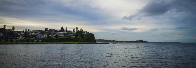
KIAMA
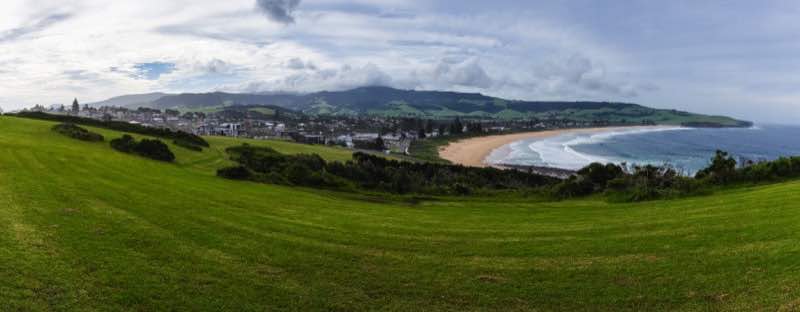
Kiama is a township 120 kilometres south of Sydney in the Illawarra, New South Wales, Australia in the Municipality of Kiama. At the 2011 census, Kiama had a population of 12,817 people. One of the main tourist attractions is the Kiama Blowhole. The seaside town features several popular surfing beaches, caravan parks and numerous alfresco cafes and restaurants. Its proximity to the south of Sydney makes it an attractive destination for a large number of day trippers.
The beaches around Kiama offer a large range of surfing conditions. Many surfing competitions are held here every year. These include Boyds Beach – Kiama Downs, Bombo Beach – Bombo, Surf Beach – Kiama, Easts Beach and Caravan Park – Kiama Heights, Kendalls Beach – Kiama and Mystics Beach – Minnamurra River.
The name "Kiama" is derived from the Aboriginal word "kiarama", which means "Place where the sea makes a noise". Kiama is also known as the place where the mountains touch the sea. This is in reference to the Kiama Blowhole which attracts a large number of visitors each year. The "Little Blowhole" is a lesser known blowhole as it does not share the same central location or the scale associated with the larger Kiama Blowhole. The Little Blowhole is on a headland south of the central part of Kiama between Easts and Kendalls Beaches.
Both have areas for viewing, though the Kiama Blowhole attracts more tourists. A coastal walking track currently allows people to walk from Minnamurra to Easts Beach, past both blowholes. A 7 kilometre southern extension to this path has been opened to allow people to walk along the cliffs to Gerringong.
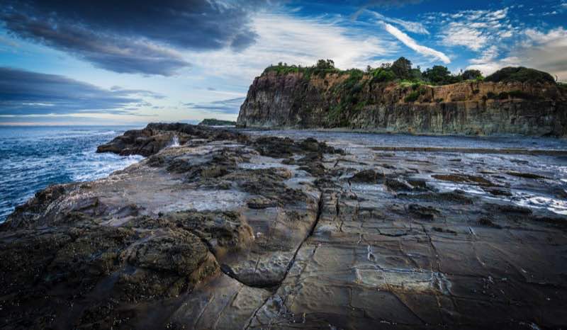
A few kilometres north at Bombo is Cathedral Rocks, a formation well known and visited, with a walk/cycleway going along the Kiama coast. There are other rock formations on these cliff headlands of moderate renown.
The Kiama Post Office, one of many historic buildings, is known for its history and pink colour, although it was repainted in 2012. It is situated near Black Beach.
Kiama has a strip mall of cafés, restaurants, art galleries and shops on Terralong Street. Also on this street is a war memorial, an historic fire station used for exhibits, and a small shopping centre. There is a strong arts following and interest in cultural events in Kiama, and in 2013 an arts trail was introduced to showcase the work of individual artists, together with regular arts events in the area. Food and wine trails are also becoming more popular in the area.
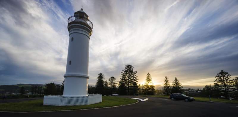
Kiama Lighthouse, on Blowhole Point, was built in 1887 and is situated close to the Kiama Blowhole. The point also contains a heritage pilot's cottage and a tourist information centre. North West of the Blowhole is Kiama Harbour, home to fishing boats and seafood market where you can buy local fish. The point also contains seaside cabins and a wonderful rock pool.
A locally famous phenomenon is the local group of Australian Pelicans. The pelicans have been honoured with a metal statue at the harbour.
Seven kilometres southwest of the town is Saddleback Lookout atop the 600-metre high Saddleback Mountain with views over the Illawarra Plains and escarpment and south to Nowra, Pigeon House Mountain and Coolangatta Mountain. Saddleback and Noorinan mountains provide an impressive backdrop to the city.
The Jamberoo Action Park, a mainly ride-orientated water-themed park, is situated 10 minutes inland of Kiama in the small town of Jamberoo.
West of Kiama in the green hills lies Jerrara Dam, built in the 1800s to supply water to the area. It is now a reserve.
North of the Minnamurra River is Killalea Recreation Area, a nature reserve on Bass Point. It is south of Shellharbour.
Kiama Council spent eleven years preparing the construction of the Kiama Coast Walk, a six-kilometre track extending from Loves Bay, north of Kiama, to Werri Lagoon, near Gerringong, south of Kiama. Some coastal land was declared public reserve to allow the public to walk through what was previously private property. The track was scheduled to open in October 2009 and was expected to be a popular drawcard for the public.

GERRINGONG
Gerringong is a town located about ten minutes south of Kiama in the Illawarra region of New South Wales, Australia in the Municipality of Kiama. At the 2011 census, Gerringong had a population of 3,456 people. One theory says that the name derives from an Aboriginal word meaning "fearful place". Supposedly great fear was caused to tribes there by the sight of Captain Cook's ship in full sail.
In the summer months visitors flock to the pristine beaches, to enjoy swimming, surfing, fishing and relaxing in the restaurants and cafés plus hunting for treasures in the shops and boutiques. There are two vineyards producing award-winning wines, one with cellar-door sales.
GERROA
Gerroa is a coastal town in the Municipality of Kiama, in the Illawarra region of New South Wales, Australia 133 kilometres south of Sydney. Nearby towns are Gerringong, Kiama and Berry.
Situated at the northern end of Seven Mile Beach and the head of Crooked River, the original village was once a retreat for various religious orders. Today it is a popular holiday town, and residence for retirees. Many houses have impressive views of the beach and Mount Coolangatta. The population is 497 according to the 2011 census, although the population swells, particularly at Easter and the Christmas−New Year break. Many holiday makers stay at the caravan park, by the Crooked River.
Nearby is Seven Mile Beach National Park, a well regarded area for bird watching, walking and fishing. Hang gliding, paragliding, sailing, windsurfing, and surfing are also enjoyed here. Black Head is suited to rock fishing, though it may be dangerous in high seas. A golf course is situated just north of the town. The rainforest remnants on the hill above the town and behind the beach contain interesting sub-tropical species, such as Snow-wood, Illawarra Plum and Camphorwood. The original vegetation was littoral (seaside) rainforest. Possums, wombats and falcons as well as many other indigenous animals may be seen near the town. Whales are commonly spotted in winter months heading north.

7 MILE BEACH
Seven Mile Beach is a long beach with strong historical reference just south of Gerringong in the Shoalhaven area of New South Wales, Australia.
In 1933 Seven Mile Beach was used by Sir Charles Kingsford Smith as the runway for the first commercial flight between Australia and New Zealand. It also has a little river/lake.
The area contains a unique littoral rainforest with several rainforest plants at their southern most limit of distribution, as well as a beach/dune/wetland ecosystem and has been used for studying sand dunes and their vegetation. Surrounding the beach are spinifex, coast wattle, tea-tree, coast banksia, she-oaks, bangalay, saw banksia, southern mahogany and burrawangs.
Its bird population includes honeyeaters, currawongs, crimson rosellas, thornbills, kookaburras, ravens, grey fantails, eastern whipbirds and white-throated treecreepoers, and even white-breasted sea eagles.
CURRARONG
Currarong is a small coastal fishing and tourist village in the Shoalhaven area of New South Wales, Australia. At the 2006 census, Currarong had a population of 513. The village is a haven for fishermen, with several underwater rises where fish are abundant. Currarong has a small general store, a newsagent and a cafe. As of early 2013 there is a fish cafe called Zac's Place, a general store, a licensed club, a caravan park, and several properties available for holiday rental.
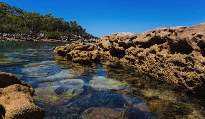
Currarong is surrounded by 14 white sand beaches, many of them deserted even in summer. Most notable are Warrain Beach and sheltered Abrahams Bosom beach. Currarong is also famous for its rock pool, and for the many protected beaches a few minutes drive away on the other side of the headland in Jervis Bay, including Long Beach, Cabbage Tree Beach and the perfectly horse-shoe shaped Honeymoon Bay.
Currarong has world class fishing - rock, beach and ocean. A spot down the cliff from Point Perpendicular is one of the few land based locations in Australia where Yellow Fin Tuna and Marlin can be caught. In 2011 a new boat ramp was completed that allows for launching two boats at a time. The area is also renowned for its scuba diving and snorkelling.
The wreck of the SS Merimbula is about 15 minutes walk. The freighter, belonging to the Illawarra Steam Navigation Company was wrecked on the Beecroft Headland in 1928. All passengers and crew were rescued. The historic Point Perpendicular lighthouse is a 10 minute drive.
Currarong is one of the few places in NSW where you can sit on a North West facing beach looking at mountains across the water, and watch the sun set over the ocean.
Whales migrate along the coastline in season and dolphins cruise the waters of the bay every day.

POINT PERPENDICULAR LIGHTHOUSE
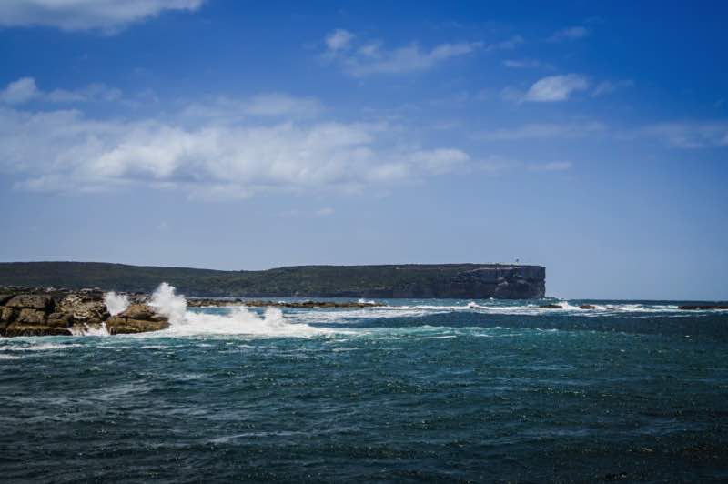
Point Perpendicular Light is a lighthouse located on Point Perpendicular, a point at the southern tip of the Beecroft Peninsula, in New South Wales, Australia. It marks and the northern entrance to Jervis Bay. The historic lighthouse was active from 1889 to 1993 and is still present, though its future is unclear. It is believed to be the first lighthouse in New South Wales which was built of precast concrete blocks. The light was replaced in 1993 with a skeletal tower which is active.
HONEYMOON BAY
Honeymoon Bay is set in a picturesque location in Jervis Bay. It is approximately 10 kilometres from the edge of Currarong along the Point Perpendicular Lighthouse Road. Honeymoon Bay is a must to spend a family day in the shade by the beach or maybe you'd prefer to do a little fishing instead.

Current South Coast Weather Forecast
South Coast